![biarri-networks-logo.png]](https://fondhelp.biarrinetworks.com/hs-fs/hubfs/biarri-networks-logo.png?height=40&name=biarri-networks-logo.png)
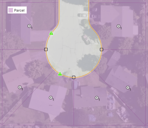
A parcel is a polygon that outlines a lot of land. A parcel usually has a single owner and contains one building that needs service. Some parcels contain several buildings, and some have nothing to serve at all, such as vacant land or a parking lot.
Parcels are used in Fiber Planner, Fiber Design, and Power Design projects.
How does FOND uses parcels?
| Use | Fiber Planner | Fiber Design | Power Design |
|---|---|---|---|
| To provide visual context for the network | ✓ | ✓ | ✓ |
| Generating underground path and leadins | — | ✓ | ✓ |
| Generating service area boundaries | — | ✓ | — |
| Showing lot lines on construction prints | — | ✓ | ✓ |
Because FOND generates other layers from your parcels, the quality of your parcels directly affects the quality of your underground path and leadins. It’s worth reviewing parcels before you generate anything from them.
What makes a good parcel?
- Lot lines sit on the boundaries between properties. FOND uses lot lines to decide where to place equipment, crossings and leadin breakouts, so accurate boundaries give you more realistic placements.
- Parcels cover private property, not streets or the right of way where the main network will be built. FOND places underground path in the space between parcels. Parcels that extend over the road can give unexpected results for generated underground path.
- There’s generally one parcel for each serviceable location. This isn’t always necessary, but it gives FOND the clearest picture of where each address sits.
Get parcels into your project
- Import with Area Select (recommended). FOND’s database includes parcels for the USA and Canada. See Import data with Area Select.
- Upload your own. Parcels must be polygons. See Input data requirements.
Review your parcels
Review your parcels before you generate underground path and leadins. Fixing a parcel now is much quicker than fixing the path and leadins generated from it later.
Use the Review problematic parcels tool to find street parcels and distant parcels and remove them before you generate underground path and leadins. Street parcels in particular can seriously reduce the quality of the generated outputs. See Review problematic parcels.
Edit parcels
- Choose Input data › Parcels › Draw.
- Make your changes:
- Add a parcel by drawing a new polygon.
- Delete a parcel by selecting it and deleting it.
- Move a parcel by selecting it and dragging it.
- Reshape a parcel by dragging its vertices.
- Cut an area out of a parcel.
- Split a parcel into two or more smaller parcels.
- Combine or Union two or more parcels into one.
- Save your changes by clicking Finish
Common edits
| Situation | What to do |
|---|---|
| The problematic parcels tool flags street or distant parcels | Delete them |
| A parcel extends over the road | Carve out the road area using the split or cut tools |
| A new development shows as one large lot because FOND’s data isn’t up to date yet | Split it into individual lots, using satellite imagery as a guide |
Tip: Use the satellite map to check lot lines and spot new developments. See Moving around the map in FOND.