![biarri-networks-logo.png]](https://fondhelp.biarrinetworks.com/hs-fs/hubfs/biarri-networks-logo.png?height=40&name=biarri-networks-logo.png)
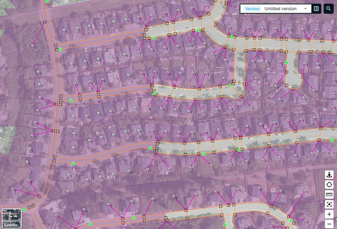
Some parcels cause problems when FOND generates other layers from them. The Review problematic parcels tool finds these parcels for you, lets you check them, and removes the ones you don’t want.
The tool is available in Fiber Design and Power Design projects.
What the tool finds
| Type | What it is | Why it’s a problem |
|---|---|---|
| Street parcels | Parcels that cover the road area itself, rather than a private lot | FOND places underground path in the space between parcels. A parcel over the road leaves no room for the path, which can seriously reduce the quality of the generated underground path and leadins. |
| Distant parcels | Parcels well away from your main design area | They can stretch generated layers out to areas you don’t intend to serve |
When to use it
Use the tool after you’ve imported your parcels and streets, and before you run data preparation to generate underground path and leadins.
FOND uses your streets to help find street parcels, so import streets first. See Streets.
Review and remove problematic parcels
- In the Input data step, open Candidate network > Review problematic parcels.
- Click the auto identify button and FOND highlights the parcels it thinks are problematic.
- Review the list. Check each parcel on the map, using the satellite map if you’re not sure.
- To keep a parcel, remove it from the list.
- To remove a parcel FOND missed, add it to the list by selecting it on the map, and then clicking Add to list in the drawing tools. Using the Delete key achieves the same result.
- Click Delete to remove every selected parcel on the list.
 When you’re done, run data preparation to generate your underground path and leadins.
What the tool doesn’t fix
Some parcel problems need fixing by hand in the parcels editor:
- Parcels that extend partly over the road. The tool finds parcels that are the road, but not private lots that spill over into it. Cut away the road area with the Cut or Split tool.
- Large lots in new developments. Split them into individual lots, using satellite imagery as a guide.
See Parcels and Drawing tools.