![biarri-networks-logo.png]](https://fondhelp.biarrinetworks.com/hs-fs/hubfs/biarri-networks-logo.png?height=40&name=biarri-networks-logo.png)
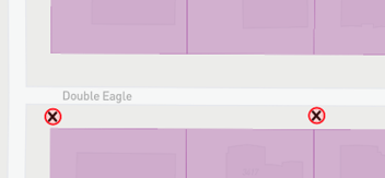
Poles and aerial spans show FOND where your network can run overhead. In FOND we call this aerial, though you may know it as overhead.
- A pole is a point marking a utility pole.
- An aerial span (sometimes called strand) is a straight line with two points, representing an overhead connection between two poles.
Together they form the aerial part of your candidate network.
Poles are used in Fiber Planner, Fiber Design and Power Design projects. Aerial spans are used in Fiber Planner and Fiber Design projects. They’re not yet available in Power Design.
How does FOND use aerial spans and poles?
| Fiber Planner | Fiber Design | Power Design | |
|---|---|---|---|
| Poles | ✓ | ✓ | ✓ |
| Aerial spans | ✓ | ✓ | — |
| Poles as the network end of a leadin | ✓ | ✓ | — |
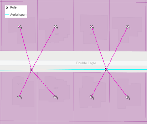
When FOND generates your plan or design, it can run cable along any aerial span and place equipment, such as hubs and splices, on poles. FOND treats every span in your candidate network as valid, so it may route cable along any of it.
What makes good aerial spans and poles?
- Poles are where real poles are. The closer your poles are to the real aerial network, the more realistic your plan or design will be.
- Every span runs between two poles and is snapped to a pole at both ends.
- Poles sit exactly on span endpoints. A pole that isn’t exactly on a span endpoint is ignored, and FOND can’t place equipment on that pole.
- Every pole is connected to at least one span or to underground path.
- There are no duplicate poles or spans.
- There are no spans where you can’t run cable, such as across a crossing you can’t get approval for.
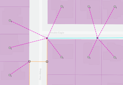
- Leadins are connected to poles wherever you want aerial service for an address. FOND may choose to use an underground service instead, if it is available.
- If you have a hybrid aerial and underground network, there is connectivity between both portions of the network. If there's not, then FOND may find a connection that you don't like.
Get aerial spans and poles into your project
| Method | Poles | Aerial spans |
|---|---|---|
| Upload your own | All projects | Fiber projects |
| Draw with the drawing tools | All projects | Fiber projects |
| Generate with Area Select | Fiber projects | Fiber projects |
| Generate from uploaded spans or poles | Fiber projects | Fiber projects |
Upload your own (recommended where you have real data)
Uploading both poles and spans gives the most accurate results.
In fiber projects, if you only have one of the two, FOND fills in the other:
- Upload only poles: FOND connects them with spans.
- Upload only spans: FOND places a pole at every vertex of each span.
Either way, check the result and fix any connections FOND got wrong.
Make sure poles sit exactly on your spans before you upload. See Input data requirements.
Generate with Area Select
In fiber projects, Area Select can turn street centerlines into poles and spans, as an approximation of an aerial network.
Review your aerial spans and poles before you design
Always review your aerial network before you run a plan or design.
Tips for reviewing:
- Remove any spans you can’t use. Otherwise FOND may route cable along them.
- Check generated or inferred data closely, especially aerial networks generated by Area Select or filled in from uploaded poles or spans.
- Use the satellite map and street view to check pole positions. See Moving around the map in FOND.
- Look for red poles. They aren’t connected to a span or underground path.
Edit aerial spans and poles
- Open the drawing tools in either of these ways:
- Input data › Aerial spans | Poles › Draw
- Input data › Modify data › Draw (design projects)
- Make your changes:
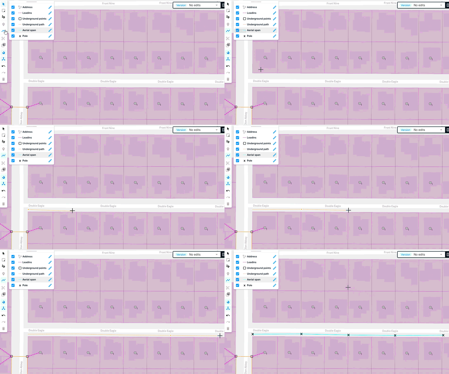
- Add spans by drawing a run of spans. FOND places a pole at every point you click.
- Add a pole by placing it on the map, or on an existing span.
- Move a pole or span by selecting it and dragging it.
- Delete a pole or span by selecting it and deleting it.
- Save your changes by clicking Finish.
FOND helps you draw connected aerial networks
- Drawing a run of spans creates a pole at every point you click.
- Placing a pole on a span splits the span at that pole.
- Placing a pole or span exactly on top of another one deletes the duplicate.
- Moving a pole moves the spans attached to it, and moving a span moves the poles attached to it.
- Deleting a pole also deletes its attached spans, because there’s nothing left to support them.
Common edits
| Situation | What to do |
|---|---|
| An Area Select aerial network follows streets that have no real poles | Delete those poles and spans |
| A pole is in the wrong place | Drag it to the right place. Its spans move with it. |
| An uploaded pole doesn’t sit exactly on its span | Drag it onto the span so the span is split there |
| A pole is missing from a span | Place a new pole on the span |
| A span crosses somewhere you can’t run cable | Delete the span |
Checks as you edit
As you draw and edit, FOND checks your poles as you work. A pole turns red if it isn’t connected to a span or to underground path. Connect it or delete it before you run your design.