What input data does FOND need?
For FOND to create a design, it needs to know
- Where to serve fiber, and
- Where cables and equipment can be placed.
The main types of input data are:
Addresses |
Geometry type: Point These are the locations of your customers - without Addresses, FOND won’t know where to lay fiber. They also describe how much fiber and/or what type of service the address needs; If you’d like to serve MDUs, check out How to control fiber allocation in FOND. |
Underground Path |
Geometry type: Linestring Underground Path indicates where Cable can be run underground. Cables running along segments of Underground path get labeled as having an Underground placement and so the different installation costs can be expressed in the BOM. |
Aerial Spans |
Geometry type: Linestring Aerial Spans are used to indicate to FOND which Poles have strand between them or can have cable hung between them. It may symbolize either an existing aerial network or a proposed one. |
Poles |
Geometry type: Point Poles represent the aerial infrastructure where equipment and cables can be attached. |
Central Offices |
Geometry type: Point This is the location(s) of where you’d like the building or cabinet with your OLTs to be placed. If you don’t have this information, you can let FOND choose for you, or just draw one on the map. You may have more than one central office available. If you provide more than one central office in the input data, FOND will be restricted to those locations when placing Feeder hubs. However, it won't necessarily use all of them if it it possible to use fewer. |


FOND only requires a subset of these layers. At a minimum, it requires either
- Addresses + Underground path, or
- Addresses + Aerial Spans + Poles.
FOND can be used to source some of these layers (Addresses and Underground path). See the article on Area Select for more information.
The GIS file formats that FOND accepts are detailed in FOND data restrictions.
How does FOND use input data?
All of the information from the input data is combined to form a candidate network. The candidate network is used to create the fiber network by placing cables and equipment at allowed locations in the candidate network. Every bit of input data is a candidate for a network design element.
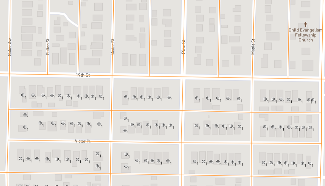
As an example, in the image above, we can see Underground Path (orange lines) in a FOND project. This is the candidate network that FOND will consider for placement of cables and equipment (network elements).
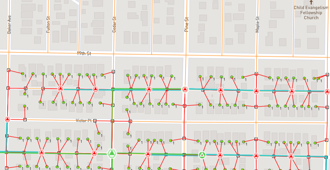
Once a design is generated, we can see the way that FOND places network elements on the candidate network, and only where it was needed - FOND will optimise the design to use the minimum amount of candidate network.